
Lorem Ipsum is simply dummy text of the printing and typesetting industry side
The Old Ta’ang (Palaung) “Territorial Dream”
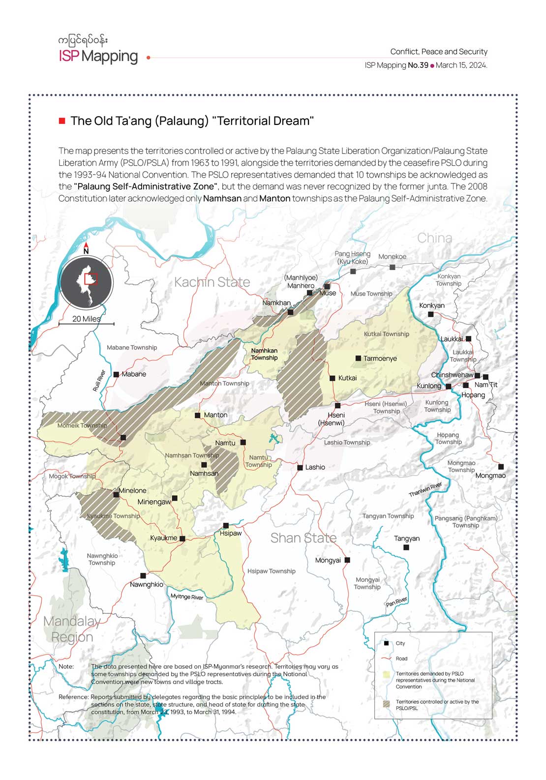
The map presents the territories controlled or active by the Palaung State Liberation Organization/Palaung State Liberation Army (PSLO/PSLA) from 1963 to 1991, alongside the territories demanded by the ceasefire PSLO during the 1993-94 National Convention. The PSLO representatives demanded that 10 townships be acknowledged as the “Palaung Self-Administrative Zone”, but the demand was never recognized by the former junta. The 2008 Constitution later acknowledged only Namhsan and Manton townships as the Palaung Self-Administrative Zone.
The map presents the territories controlled or active by the Palaung State Liberation Organization/Palaung State Liberation Army (PSLO/PSLA) from 1963 to 1991, alongside the territories demanded by the ceasefire PSLO during the 1993-94 National Convention. The PSLO representatives demanded that 10 townships be acknowledged as the “Palaung Self-Administrative Zone”, but the demand was never recognized by the former junta. The 2008 Constitution later acknowledged only Namhsan and Manton townships as the Palaung Self-Administrative Zone.
Recaptcha test
Recaptcha test 2
Recaptcha test
Hello testing